Apr 26, 2011
Mar 19, 2011
Alaska Gear List
Fairbanks is turning out to be more expensive to fly into, so we might not have saved very much money by switching locations, but we will be truly off the grid so it should be amazing. Rob is planning on flying into Anchorage and renting a car to drive to Fairbanks which if several people go in on with him will save a considerable sum. If you are interested in doing it with him shoot him an email (or me if you don't have his address).
Below is a basic gear list (not extensive). Please let me know what you can offer for group gear so we can plan and cut some weight:
Personal Gear (be prepared, read up on Alaska range weather and plan accordingly, we could be up against anything even in June):
- backpack (make sure it fits, ask Mike if you want to know how much it sucks if it doesn't)
- sleeping bag
- therma rest or other mattress/ground pad
- bag liner (optional, but it could get pretty cold at night even in June)
- boots (good ones, think Scarpa or Asolo)
- sandals or comfort shoes for around camp and possible river/creek fording
- socks and sock liners (optional) to limit rub
- clothes for temperature range of 35-70 degrees (think in layers)
- rain shell or poncho
- pack rain cover or dry bags for inside your pack (optional, most packs are treated to be water resistant nowadays)
- 2-3L water carrying devices (bottles or pack bladder etc.)
- Food (email me if you want idea's, plan for 3000 calories a day)
- Stove (if you don't have one there are enough in the group to share, but let me know so we plan enough fuel)
- matches (waterproof)
- flashlight and extra batteries
- first aid kit (small should suffice, I will bring a larger group kit)
- map and compass or GPS
- bug spray (the bugs are supposedly pretty bad so don't skimp, if you are buying any new clothes for the trip pop for clothes with Bug-Off, it works really well)
- bear spray or pepper spray (check TSA website for exact maximum allowable in your luggage)
- Gaitors for higher elevation travel (could be some snow pack, we can abort if it gets too deep)
- Crampons (may be useful depending on conditions, we'll check the week before the trip)
Group Gear
- tents
- tarps or ground covers
- bear cans (might end up being a personal item, you can rent from REI)
- saw (I'm bringing one)
- hatchet
- Stove's and fuel
**if you think of any additions let me know.
Feb 26, 2011
Reservation Made!
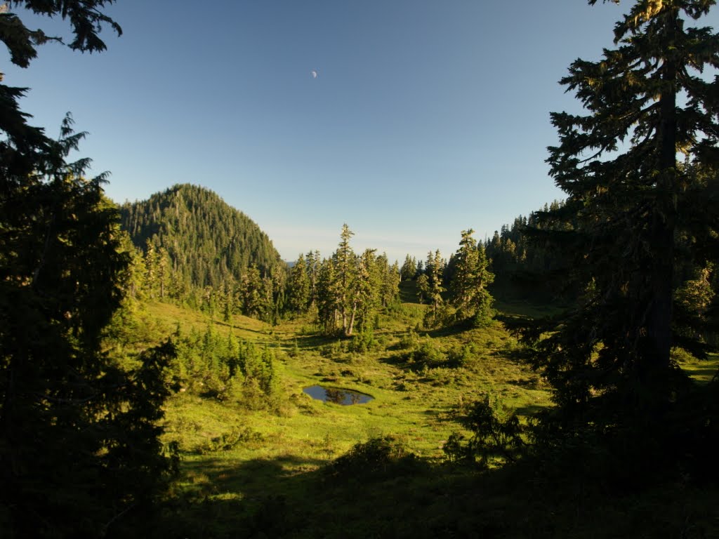
With the help of Uncle Randy's friend "Moose" in Fairbanks we have switched gears a little bit and we now have our reservation for the puddle jumper. Instead of flying into Lake Clark we are now flying to Kansas Creek Strip (click for picture on the wood river near the landing strip) in the Denali area of Alaska, south of Fairbanks. I have a lot of different route options but no matter how we go about it we will start and end at Kansas Creek, so we can set up a base camp near there and do day trips each direction, or we can do a multi day circuit up through the mountains behind the landing strip, over, down, and follow the river back up. We can even decide when we get there and see the the surroundings, just pick the path that interests us most and have at it.
Our reservation is complete! We have a reservation for 9 people to fly into Kansas Creek on morning of 25 June and the planes will return to pick us up on the afternoon of 29 June, so 5 days on the ground. We will be taken in on 4 person planes, 1 pilot and 3 passengers to each plane and everybody is limited to 40 lbs or less of gear. That's important so keep it in mind as you start to get ready. The total cost for 3 planes round trip is only $3600, less than half of what Lake Clark was going to cost us. Right now we are 8 confirmed which means the price is $450 per person if we go up to 9 people the cost is a mere $400 per person round trip. We can add another plane if we go over 9, the max is 3 passengers per plane with 40 lbs gear per person. I made a $600 deposit so we are all set. We will be flying out of Fairbanks, so buy your tickets into Fairbanks not/not Anchorage. Our air taxi is reserved with Wright Air Service.
I will post a basic gear list and a group gear list soon. If anybody is in the market for a Bear can this is the trip to justify the purchase with. The area is full of bears, moose, caribou, and dall sheep (mountain sheep). Here is my list of who is attending as of right now, if anybody is having second thoughts or if anybody else wants to come let me know asap:
Doug
Gary
Jeff
Mike
Randy
Rob
Seth (Jeffs friend)
Zachariah
Maybe's:
Ben
Greg
Hunter
Chris
Dec 7, 2010
Float Plane Price for Lake Clark
I have now received quotes from several bush taxi services in Alaska and the prices are a little higher than I found last year when first starting to look at this hike. The lowest price quote we have right now is from Lake Clark Air at $715 per person with 50 lbs gear max per person. I had hoped to get the price down lower to around $500 per person. However, the economic downturn seems to have driven a lot of outfits out of business and so most of the ones I had talked with last year are no longer around. Seems like less competition equals higher price... This price is the 2010 price and will go up 10% on January 1, per Lake Clark Air. It's a total sales pitch, but they have offered to give us this years price if we make our reservation and pay deposit by 1 January. If after that time someone decides they cannot come then we can still apply the full balance to the final price of the actual travellers, so no loss of money if someone has to back out. They will also allow us to add people as long as we give them notice two weeks prior to our trip. On top of this price everybody has to get to Alaska which could make it too expensive. Let me know individually what you think, if the price is too high let me know. The deposit is 50%, so around $350 now, and the remaining in about April.
I'm about decided on the actual hiking routes. I talked with a park historian last week that told me the Mulchatna drainage has a lot of black bears in June, fishing in the rivers. He built me up a lot, got me all excited, and then caveated it with "...but one year we had some hikers that spent a week hiking in the area and only saw some squirrels...", so we'll see. The area has a lot of bears but because it is not well travelled like other Alaskan parks the bears are not used to human's at all and will be more skittish and less willing to check out our camp. Another stop I would like us to make is along the northern side of lower twin lake to see the Dall sheep. I talked with a ranger in Anchorage that told me about a natural salt lick that attracts the sheep. They are usually rare but we have a good chance of finding them if we locate the salt lick.
For some really amazing photo's around Turquoise Lake, Twin Lakes, and the Mulchatna River click here.
Current party members (confirmed via email):
Mike
Jeff
Doug
Rob
Marcus
Randy
Gary
Possible party members:
Ben
Greg
Hunter
Chris
Nov 29, 2010
Trek 2011

Telequana drainage (Photo courtesy of NPS.gov)
I am back from Cappadocia and in full on expedition planning now. The votes were unanimous in favour of going to Lake Clark National Park in Alaska so I'm starting to work out the details. I expect to have a price for the puddle jumper round trip Anchorage - the park - Anchorage figured out here in the next week or so. I'm coordinating with a couple different outfits to see the best price and options for our flight.
There are a couple of things I would like to hear everybody's opinions on, some of which will help me in coordinating the flights into the park. I'm basically thinking of a couple of different options for our trip:
Option 1: We hike the Telequana trail from Telequana Lake to Twin Lakes. The park is trailless, so the name of the route is sort of a misnomer. It is reference to a general route the Telequana indians used to migrate I believe. The region of the park is mostly tundra covered making the hiking part of it easier with less bushwacking, but it is no less wild or beautiful. Direct route would be about 30-35 miles and would cross several rivers we have to ford with bears, moose, and other wildlife to see.
Option 2: We get dropped by float plane on Turquoise lake and set a base camp there on the end near Mt. Telequana. Then we make day trips each day exploring in each direction with daily roundtrips of 10-15 miles. My inclination would be to climb Mt. Telequana one day, it's not tall by world standards but still a 6500 ft climb from the lake bed. Then one day hike down the runoff and find some grizzlies, etc. This option would make timing easier since we would be picked up at the same place, so if we are slower than we think one day it's not going to make our final day a race to meet our plane.
Either option will allow us to see a lot of amazing territory and either way the price of the single engine plane ride into/out of the park will be the same. So let me know what your thoughts are, and vote on the poll on the side for which option interests you most.
Current plan:
Hike dates: 25-28 or 29 June 2011 (plan to start hiking on morning of 25 June)
Current party members (confirmed via email):
Mike
Jeff
Doug
Rob
Marcus
Zachariah
Rumored members (not yet confirmed):
Randy
Hunter
Curtis
Please let me know if you are coming for sure or if any of your plans change.
Sep 3, 2010
Quinalt Rainforest

Left to right: Zachariah, Hunter, Mike, Jeff, Doug, Eldon, Randy at the Ivery lake trail head
This year we returned to the Olympic National Forest for our yearly "Man-Hike" as my family now refers to it. None of us have spent much time in the Olympics so when we were doing the planning we thought we would try and do a north to south transect of the national park. We only had 4 days to do it and when I started the planning I had some bad information that said it was only a 3-4 day hike. Turns out that was pretty unrealistic, the actual mileage was near 60 miles through pretty rough terrain in some parts. We probably could have pulled it off hiking 15-20 miles a day, but it would have been rough. So we settled on an easier trek up to the Skyline Ridge trail in the Olympic Wilderness area, climb up to Kimta Peak, and then descend to the valley and Quinalt river and follow it back to the Ivery trail head.

The trail started out easy enough. The rainforest is nice and cool and there were toads everywhere, literally, it was hard not to step on them there were so many. Just like in 2009, we picked the perfect week to do our hike with beautiful blue sky, sunshine, and high temperatures. The only downside is we had some serious elevation gains along the way, which coupled with the heat made the hiking a little rough.


Doug getting some water

Jeff contemplating the vast size of the "World's Largest Yellow Cedar" standing behind him on the right side of the picture, we were expecting a tree you could drive Grandma's Oldsmobile through, apparently old growth cedar don't get that big
The first day we started out on the Ivery Lake trail and climbed up 4000 feet in 11 miles past the Three Lakes camp and stopped at the Three Prune camp.

Alpine lakes scattered along the trail up to Three Prune

"Ah, young Grasshopper I will teach you in the way of the Jetboil...", Eldon and Hunter making some food

Resting at camp, Randy looks beat, Doug is ready for another 5 miles

Jeff felt like he needed to work on his abs after a long day of legs only workout

The group at Three Prune campsite, I don't know what happened to Doug in this picture
We set out early the next morning leaving our camp set up at Three Prune. The plan was what looked like an easy 10-12 mile round trip along the Skyline Ridge primitive trail to Kimta Peak and back. The elevation gain per the map was no more than about 1300 feet. We should have looked a little closer about how many times the trail crossed back and forth over the contour lines. By the end of the day we had ascended another 4121 feet of elevation with a net gain of zero as we made it back to Three Prune. It also didn't help that we went about 4 miles past Kimta Peak before we realized we had passed it. The total mileage for day 2 was 16 miles. Mike and I came up on a good size black bear on the trail right before we decided we had gone too far, so it wasn't a total loss. We tried to follow him which worked for like 100 feet until he decided he didn't like us. He turned and looked at us, peed, poo'ed, and then ran off the trail into the bushes.
Before we left Three Prune for Kimta Peak we had met some hikers that had come from that direction. They told us there was no water between the campsite and Kimta Peak. So expecting none we pumped a lot but within a mile of camp saw the first bit of water melting into a large pool from a snow patch. After we passed Kimta Peak (though we didn't know it was Kimta Peak at the time) we started seeing good creeks every few minutes. Mike, Jeff, and I kept scoffing at the bad information... until we realized we had passed Kimta by like 4 miles. Oh well, we saw a bear and the ridge trail has some amazing views, so no loss there.

The real Kimta Peak


Following a black bear

Getting a little closer

Dead shade trees

This water looked soo delicous, I was a little dehydrated. I drank almost 5 liters of water on the Kimta hike day and still couldn't pee at the end of the day!

Looking across at what we mistakenly thought was Kimta Peak from the actual Kimta Peak

West of Kimta Peak

South of Kimta Peak

Doug

Randy and Jeff pumping water

Morning fog creeping up out of the Quinalt river valley


The 3rd day we packed up Three Prune camp and headed down into the Quinalt River valley. We still had to ascend out of the camp area and by the time we hit the valley floor we had ascended another 921 feet bringing our total gross elevation gain for the trip to just over 9000 vertical feet. On the valley floor we had dropped all but 500 feet of our elevation gain. We rested at the trail intersection next to the river. When Randy got there we told him we had to go 3 more miles to camp and he gave us the signature Randy "you're kiddin' me!". Apparently the whole trip we kept telling him "just three more miles..." and then it was really like 6 or 8 more miles until the real end. When we got to the river campsite only 2.5 miles from the parking lot we all decided it would be real nice to have Subway, surprise our wives with an early return, and sleep in real beds so we pushed on to the cars. Subway was good, the wives had sent the kids to Grandma buttons house so they could have a girls night and so they were not really excited to see us, but it was sure nice to sleep in a real bed. The total mileage for 3 days was just over 40 miles. The Quinalt rain forest and Skyline Ridge were beautiful. We'll be back!

Descending into the valley

Reaching the valley floor

Finally made it to the river, water was a balmy 57 degrees
Jul 20, 2009
Mt. Rainier


Greg, Jeff, Zachariah, Ben, and Mike (I don't know why but Paul is missing) getting ready to start walking
After registering and collecting our blue bags we started climbing at about 0900. We couldn't have asked for better weather. We originally planned 4 days in case the weather was bad and it took longer to climb, but we had amazingly clear weather for the whole climb.

Enjoying the first Clif bar
When we got to the lodge and were getting ready to climb I found that my sunglasses had disappeared and so I had to buy the one pair of non-geriatric looking glasses in the gift shop. When I got back from the climb it turned out Bran had been looting my pack and had taken the glasses right before I left.

Pebble Creek, just before the ice starts (Jeff, Greg, Paul, and Mike)

Bathroom with a view of Mt. Adams (Ben)

Still a long way before Camp Muir (Paul, Jeff, and Zachariah)

500 ft below Camp Muir with Cathedral Rocks in view


Arriving at Camp Muir, finally

Digging out a pad for our huge 6-man base camp tent

Making water for the summit climb (Zachariah)
We burned through 3-4 liters per person of water on the first day, which is normal. And on the summit bid you have to have about 1 gallon of water per person, so after setting up the tent we started melting/filtering the water for the next days climb. It took about 2.5 hours to melt all the water and cook all the food.

Sunset from Camp Muir

Climbing up to Cathedral Gap from Camp Muir (Mike, Greg, Jeff, Paul, and Ben)
Most teams woke up around 0100 and kicked off for the summit bid in the dark. We were a bit lazy however and tried to get up at 0300, rolled out of bed around 0400 and left for the summit climb at about 0500. The nice thing about it was that we didn't have to climb by flashlight.

Stepping onto the Ingram Glacier from Cathedral Gap

The first look at the Disappointment Cleaver from Ingram Glacier (Zachariah)

View of Mt. Adams through Cadaver Gap on the Ingram Glacier (Ben)

Making our final approach to the Disappointment Cleaver

Weird spikey snow on the Cleaver

Looking down on the Ingram Glacier from the Cleaver

Clambering up the lower skree patch on the Cleaver

Settling in for a long break
After a long push to get to a safe place to rest we stopped on a small skree patch on top of the Cleaver and took about a 40 minute break. At this point we started to see the first successfull summit teams coming down from the early morning groups. We had come across a few unsuccessful groups that had had to return without making it to the top.

Ben jumping over a skinny and very deep crevasse

Greg jumping over the same crevasse

Checking out the last really big crevasse before the steep final climb (Paul, Greg, Jeff, Mike, and Ben)

Looking down on Little Tahoma from Emmons Glacier (Greg, Mike, Ben)

The summit (Greg, Jeff, Ben in back, Paul in front, Mike, and Zachariah)
We summited at about 1530 on 16 July with two strained knees and one migraine as our only group injuries. We sat down in the crater to rest and Ben started going sort of crazy. He had a steadily worsening migraine as we climbed and at the top it became so unbearable that he could hardly walk. When he started asking us to medevac him we decided it was time to get down some elevation and see if it would ease the pain, so we only spent a mere few minutes at the top. It was really an amazing climb, extremely difficult, and beautiful. After summiting we turned around and made it back to Muir around 2100, a grueling 16 hour day.
A couple of months before the climb I had this dream that we all got to the top and there was a Japanese tourist bus there and someone had built a road up the other side. We were really angry in my dream after half killing ourselves to get up there. Well, as we approached the summit we passed the last team to come off the top before we got up there, and it just happened to be a 4 man Japanese team that flew to the States just to summit Rainier! How random is that?
Subscribe to:
Posts (Atom)